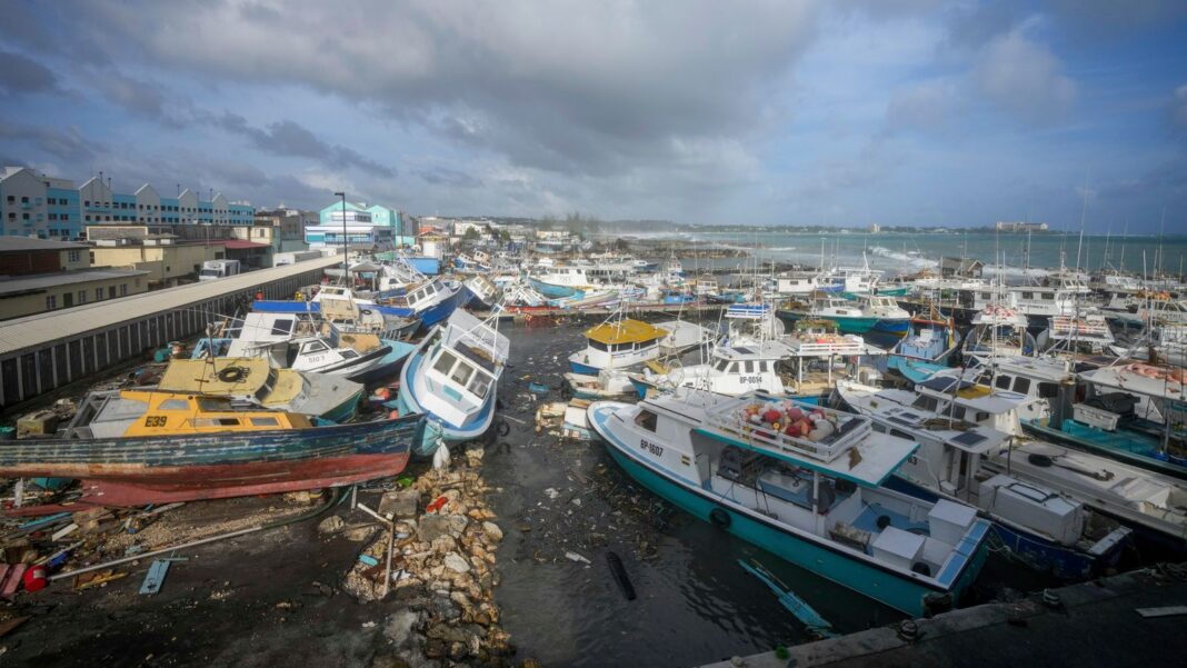
Hurricane Beryl has battered islands in the eastern Caribbean, killing at least six people and is now barrelling towards Jamaica.
Although it’s weakened to a category four storm, a hurricane warning is still in place for Jamaica, Grand Cayman, Little Cayman, Cayman Brac and Haiti’s southern coast.
Beryl is the earliest storm on record to hit the Caribbean with such strength.
But why did it form so early in the year and why has it been so intense?
Climate change leads to warmer oceans
Warmer oceans are likely to be behind the unusually early formation and rapid intensification of the storm.
The water in the Atlantic is “hotter than it would normally be at the peak of the season,” Brian McNoldy, a tropical researcher at the University of Miami, told Sky’s science correspondent Thomas Moore.
Orange areas indicate water that is 2-3C warmer than normal
Sea temperatures along the hurricane’s track are 2-3C warmer than normal.
“It’s pretty amazing. In terms of sea surface temperature, it’s warmer than it ever gets during the peak of the season,” said Mr McNoldy.
“In terms of ocean heat content, it looks like the peak of hurricane season – the second week of September. It’s pretty astounding.”

The waterfront in Soufriere, St Lucia, also suffered damage. Pic: Reuters
Global warming has helped push temperatures in the North Atlantic to record highs, added Christopher Rozoff, an atmospheric scientist at the US National Centre for Atmospheric Research.
He said warmer waters lead to more evaporation, which fuels more intense hurricanes featuring higher wind speeds.
How powerful is Hurricane Beryl?
Beryl leapt from a category one to a category four storm in under 10 hours, according to Andra Garner, a meteorologist at Rowan University in New Jersey.
She said it’s the fastest intensification ever recorded before September – the peak of the Atlantic hurricane season.

Beryl will reach Jamaica on Wednesday before heading towards Mexico
Beryl had maximum sustained winds of 155mph (250kmh) at 5pm EDT on Tuesday, according to the US National Hurricane Center (NHC).
It estimates it’s moving west-northwest at 22mph (35kph) and will hit Jamaica at 2pm EDT (7pm UK time) on Wednesday.
It is expected to bring life-threatening winds and a storm surge, and officials have warned people in flood-prone areas to prepare for evacuation.

Hurricane Beryl from space. Pic: International Space Station/X/Reuters
Beryl will still be near major hurricane strength when it reaches Jamaica, as well as when it arrives at Mexico’s Yucatan Peninsula and Belize late on Thursday, the NHC said.
Its course and power over the western Gulf of Mexico at the weekend are currently uncertain.
How unique is Beryl?
It’s broken several records, including being the farthest east a hurricane has formed in the tropical Atlantic in June, said Philip Klotzbach, a hurricane researcher from Colorado State University.
It strengthened from a tropical depression to a major hurricane in 42 hours.
It’s something only six other Atlantic hurricanes have done – and never before September, hurricane expert Sam Lillo told Associated Press.
Climate change’s likely contribution to the early formation and intensification of Hurricane Beryl could be an alarming preview of future storms.
The National Oceanic and Atmospheric Administration predicted in May that the 2024 hurricane season would be well above average, with between 17 and 25 named storms.
It suggested there would be as many as 13 hurricanes and four major hurricanes.
An average Atlantic hurricane season typically produces 14 named storms – seven of them hurricanes – and three major hurricanes.


