
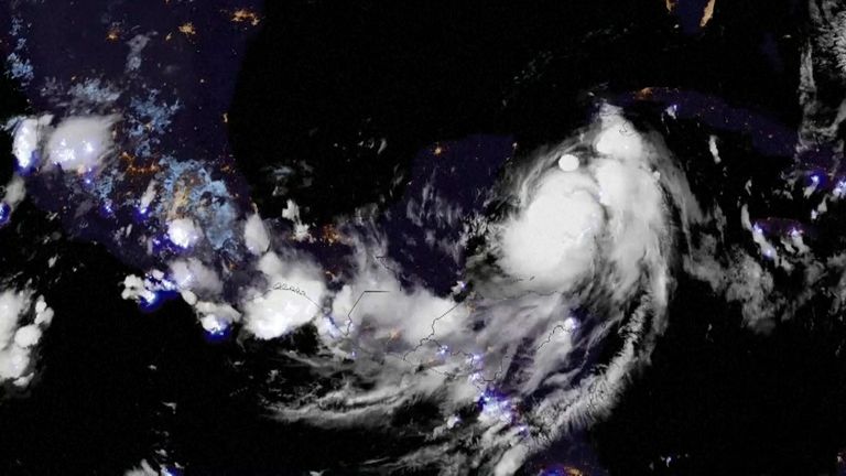
A rare blue supermoon could play a role in exacerbating the flooding effects of Hurricane Idalia which is heading towards Florida’s west coast.
Residents of Florida’s Gulf Coast have been warned of a risk of life-threatening storm surges and dangerous hurricane-force winds over the next two days as the Category 3 hurricane is expected to hit Florida’s northwestern coast at around 6am local time on Wednesday.
The blue supermoon will also be closest to Earth on Wednesday night, making tides higher and flooding potentially worse, not only in Florida but in Georgia and South Carolina.
Known as a king tide, these higher tides are caused by the extra gravitational pull that occurs when the sun and moon align with Earth.
Brian Haines, the meteorologist in charge at the National Weather Service office in Charleston, South Carolina, said: “I would say the timing is pretty bad for this one.”
He warned residents that some parts of Charleston could be underwater by Wednesday night.
Another deadly threat that Idalia poses is a surging wall of water 8ft (2.44m) to 15ft (4.5m) high that could flood low-lying areas along Florida’s coast, according to authorities.
Known as storm surges, these happen when high winds and atmospheric pressure from an oncoming hurricane force ocean water up onto land.
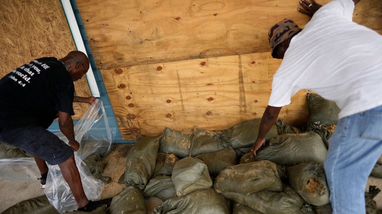
Preparations in Cedar Key. Pic: AP
A storm surge is often the most destructive aspect of a hurricane, Sky News weather producer Kirsty McCabe said.
Hundreds of miles of Florida shoreline are under storm surge warnings, from Apalachicola Bay to Tampa, the state’s third-largest city, and down to Sarasota in the south.
Read more:
Why could Hurricane Idalia be more dangerous than usual?
Everything you need to know about this week’s supermoon
Lightning strikes in Storm Idalia
The National Weather Service’s Storm Prediction Centre has also warned that the hurricane could create tornadoes as it moves over the state.
The storm could bring 10 to 20cm (3 to 8in) of rain and winds of up to 120mph (193kph).
The National Hurricane Centre issued the warnings after Cuba was hit with heavy rain, flooding and landslides.
‘One word: Leave’
Idalia is the first storm to hit Florida this hurricane season, a state that is also dealing with lingering damage from last year’s Hurricane Ian.
The National Weather Service in the city of Tallahassee called Idalia “an unprecedented event” since no major hurricanes on record have ever passed through the bay bordering the Big Bend region.
On the island of Cedar Key, Commissioner Sue Colson joined other officials in packing up documents and electronics at City Hall.
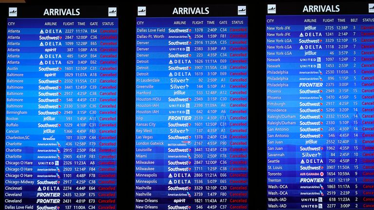
Cancelled flights at Tampa International Airport. Pic: AP
In a message to the almost 900 residents who were under mandatory orders to evacuate the island, she said: “One word: Leave.
“It’s not something to discuss.”
State of emergency in 49 Florida counties
On Tuesday, Florida Governor Ron DeSantis declared a state of emergency in 49 of Florida’s 67 counties that stretch across the Gulf Coast to the Atlantic Coast.

Hurricane Idalia: ‘Make your final preparations’
About 1,100 National Guard members, who have 2,400 high-water vehicles and 12 aircraft at their disposal for rescue and recovery efforts, have also been mobilised.
“We’ve not really had a hurricane strike this area for a long, long time,” Mr DeSatnis said.
At least 23 Florida counties have posted evacuation orders on their websites or social media pages as of Tuesday morning, including for parts of Tampa.
Pic: AP
From the Gulf Coast, the storm will move eastwards across the north of the state, just north of Jacksonville, before it reaches the border with Georgia at around 6pm.
Beyond Florida, it will move along the Gulf of Mexico coastline to Georgia, South and then North Carolina on Wednesday and Thursday.


